Strip, Map & Excavate, Llanymynech, Wales
An enigmatic landscape emerged from remote prehistory during our recent excavations alongside the Montgomery Canal in Mid Wales on behalf of Glandŵr Cymru: The Canal & Rivers Trust in Wales.
In Brief
Archaeological Evaluation
Archaeological Mitigation & Excavation
Key Points
- Two mysterious pit alignments
- Proposed construction of a new road bridge over the canal
Summary
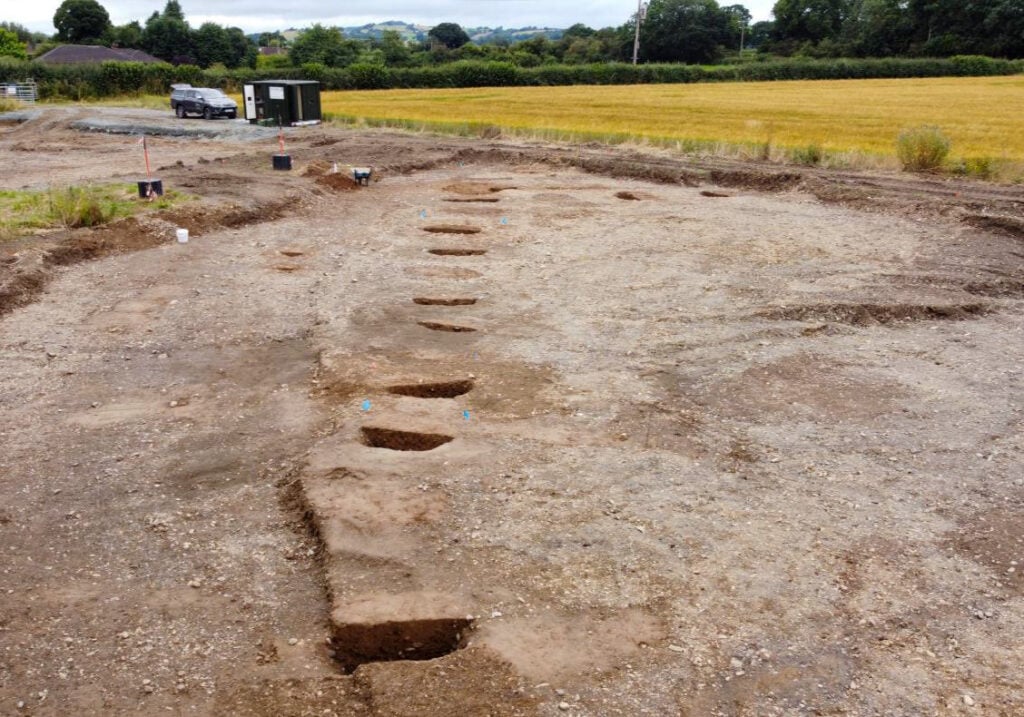
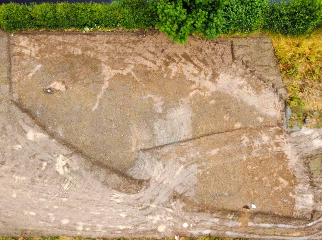
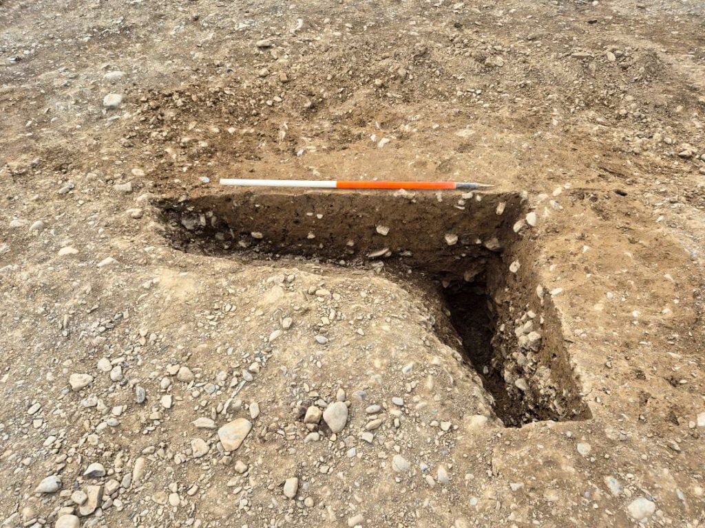
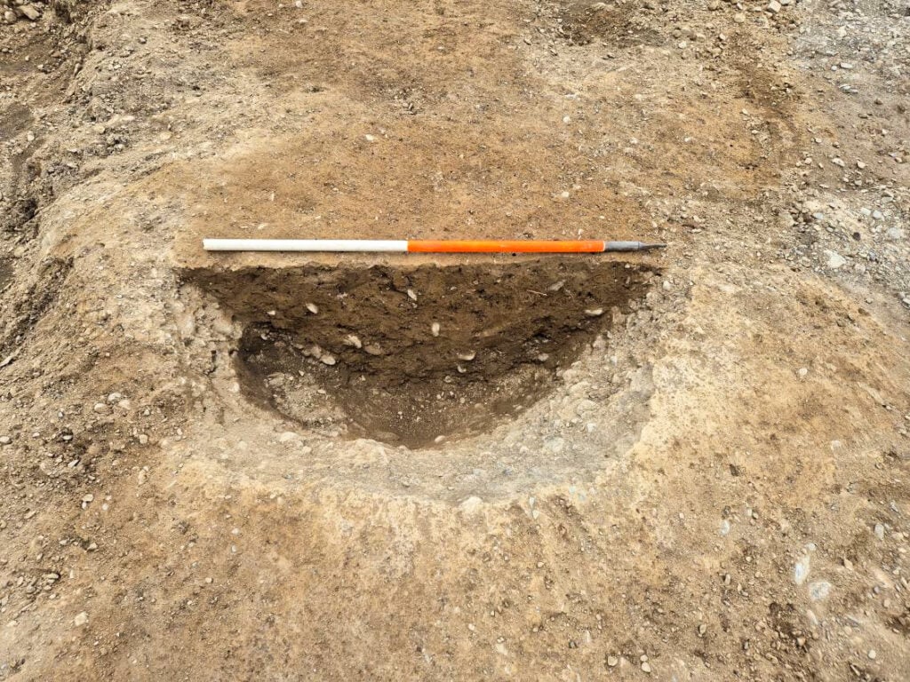
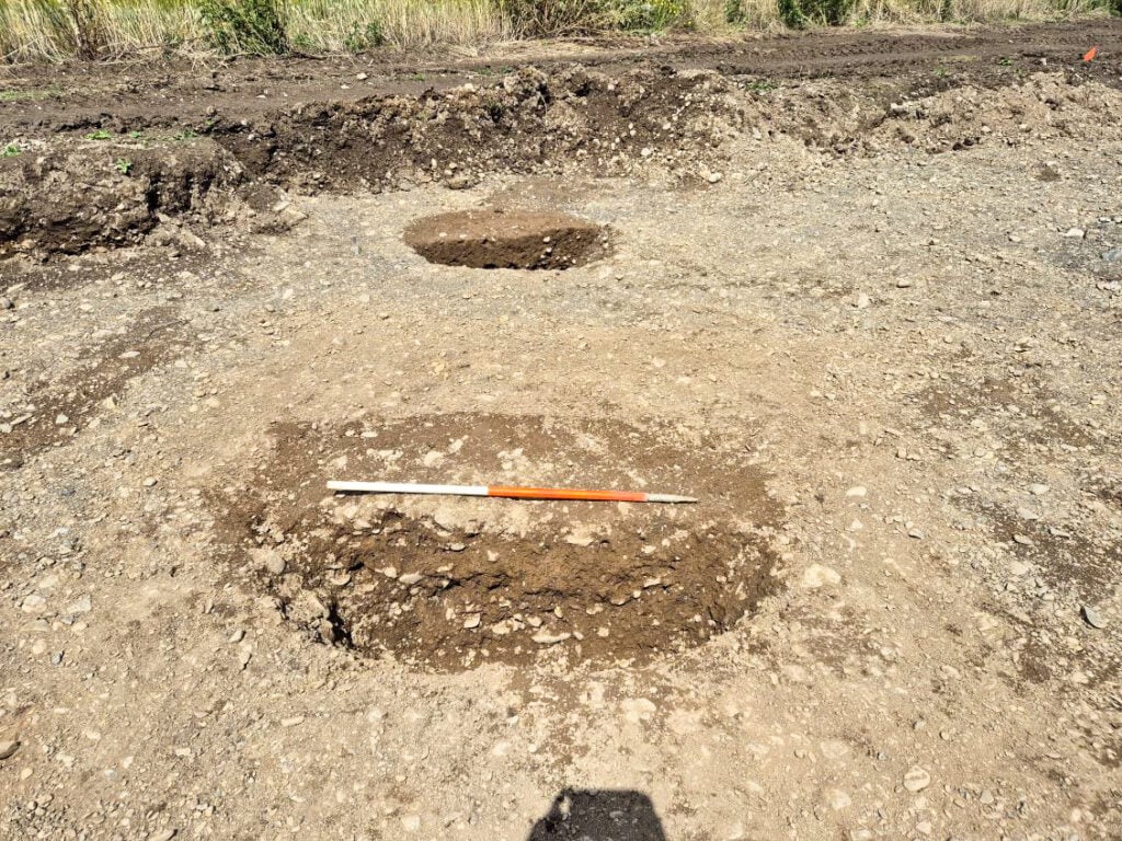
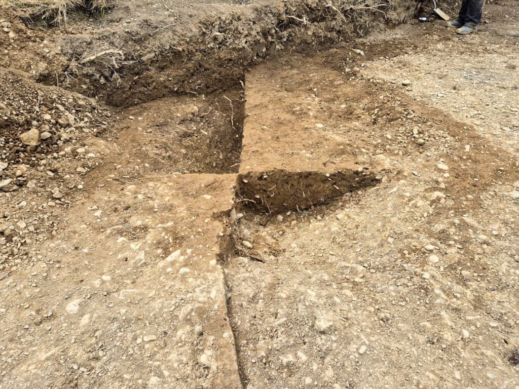
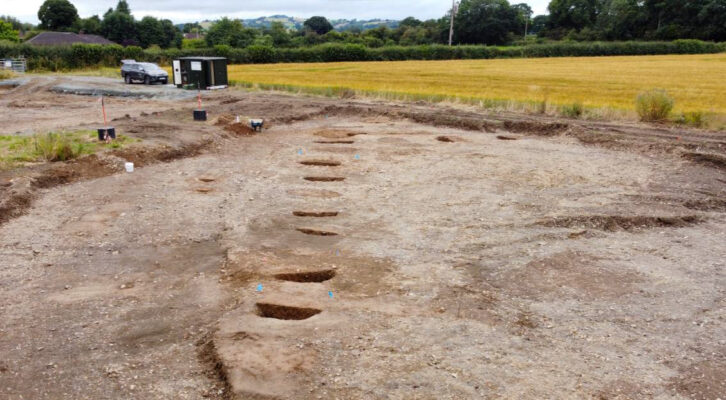
Long buried under rolling farmland to the north of Welshpool, where the village of Llanymynech sits astride the Welsh border, two mysterious pit alignments visible only as dotted lines of cropmarks on aerial photographs could be seen running for some distance across fields bordering the canal.
Little was known about these alignments but other examples have been found in the area and they are known elsewhere in the Welsh Border and beyond. What they represent remains something of a mystery and a challenge to the modern mindset but it is thought they may have a connection with prehistoric land division and territorial ownership. Some well-preserved examples have banks running along one or both sides, which, in areas with a history of cultivation, may have been levelled by ploughing.
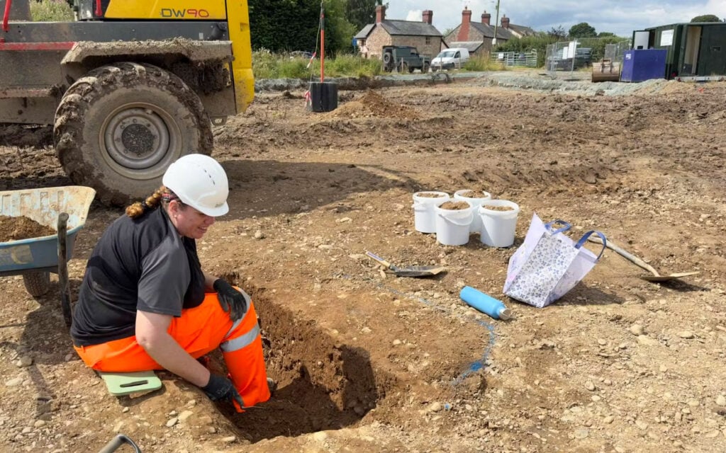
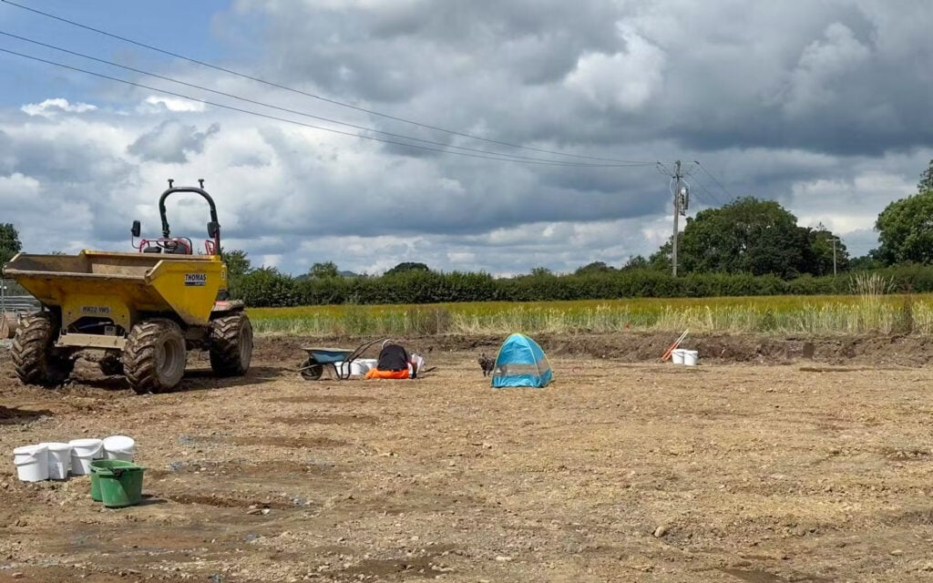
The proposed construction of a new road bridge over the canal on Carraghofa Lane, Llanymynech, presented an opportunity to investigate this prehistoric mystery. Ahead of construction work, a programme of Strip, Map & Excavate investigation was implemented on both banks of the canal, which revealed two adjoining linear pit alignments, one running broadly northeast to southwest and the other northwest to southeast. Three roughly linear ditches and an isolated pit were also found while a phase of post-medieval disturbance associated with the construction of the canal was also identified.
None of these pits contained any dating evidence but similarities to the more than 20 closely spaced pits previously found nearby at Four Crosses suggested a Late Neolithic to Early Bronze Age date, with one of the ditches also belonging to this same prehistoric period, while the other two ditches and the isolated pit remaining undated.
Results
It now remains for Border Archaeology to return to site to carry out Archaeological Observation of bridge construction works when further evidence of prehistoric land use, as well as information on the construction of the canal, may well come to light.