Photogrammetry
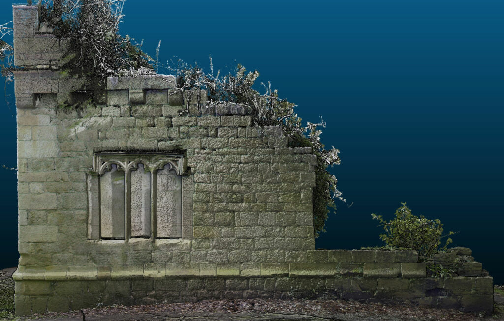
Archaeological 3D modelling is a technique to create a virtual representation of any object or surface.
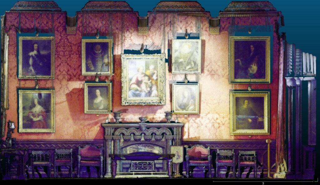
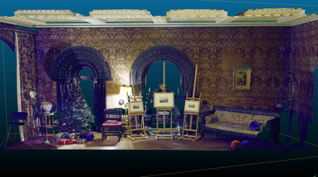
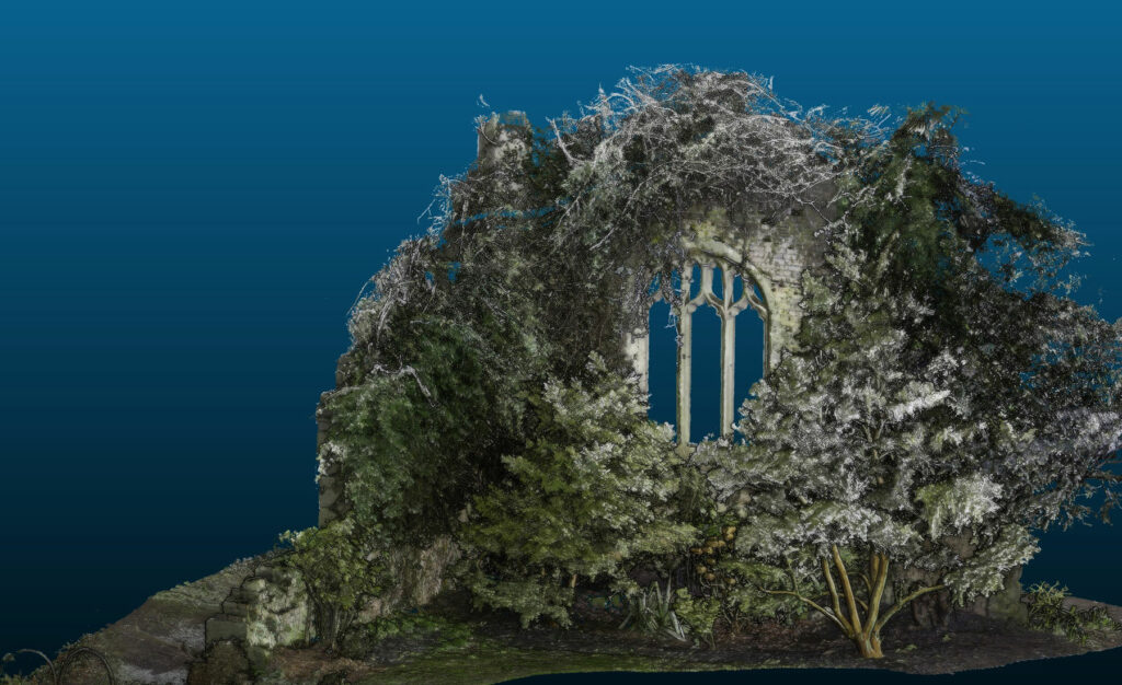
Photogrammetry is a method of creating a 3D model and is a process in which multiple photographs are taken in order to reconstruct an object or surface and which can then be scaled, giving a virtual reconstruction of a real world subject.


What Happens Next?
Creating 3D models follows a similar process to creating aerial photos as it follows the same process – taking large amount of photos with between 20-60% overlap and running it through software which then reconstructs the camera location, orientation, lens type and lens distortion. This is done by comparing and matching pixels across the photos in the entire scene and triangulating the visual features of the object. From this, a mesh is created which can then be texturised to create an accurately scaled 3D or 2D geometric representation of whatever object is being recorded and from which measurements can be taken.
Any camera can be used to create a 3D model as long as the photographs have the object in the centre taking up the majority of the image. It is important to take plenty of photos and ensure that the light remains the same with no shadows or bright light sources as these can cause the software to mismatch the points.
Photogrammetry is a powerful and useful tool and can be used on a variety of projects, including Historic Building Recordings, Field Evaluations and Archaeological Mitigation.
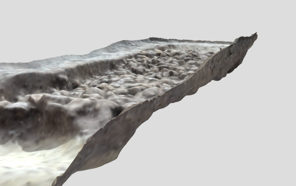
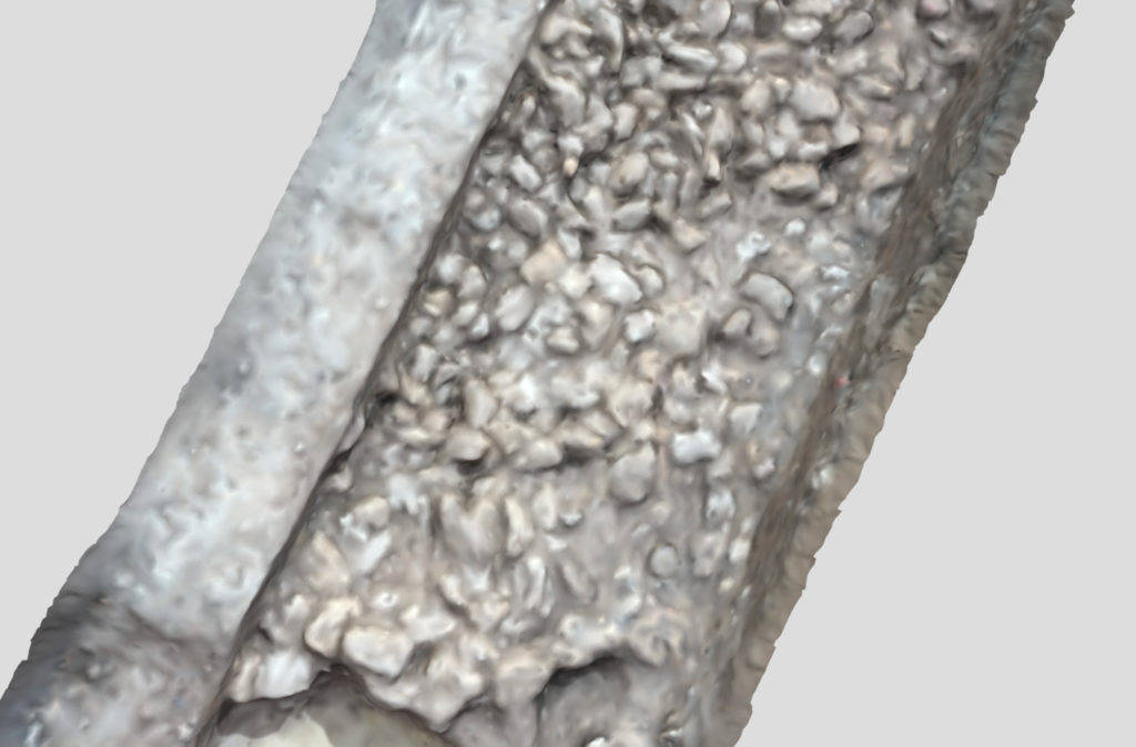
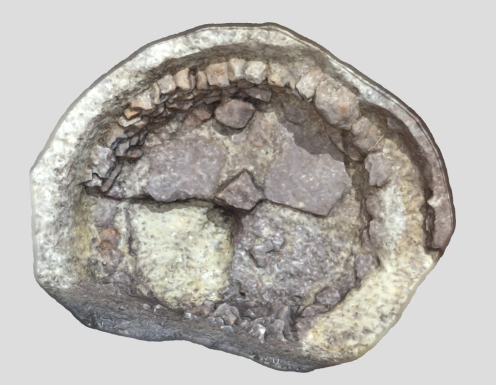
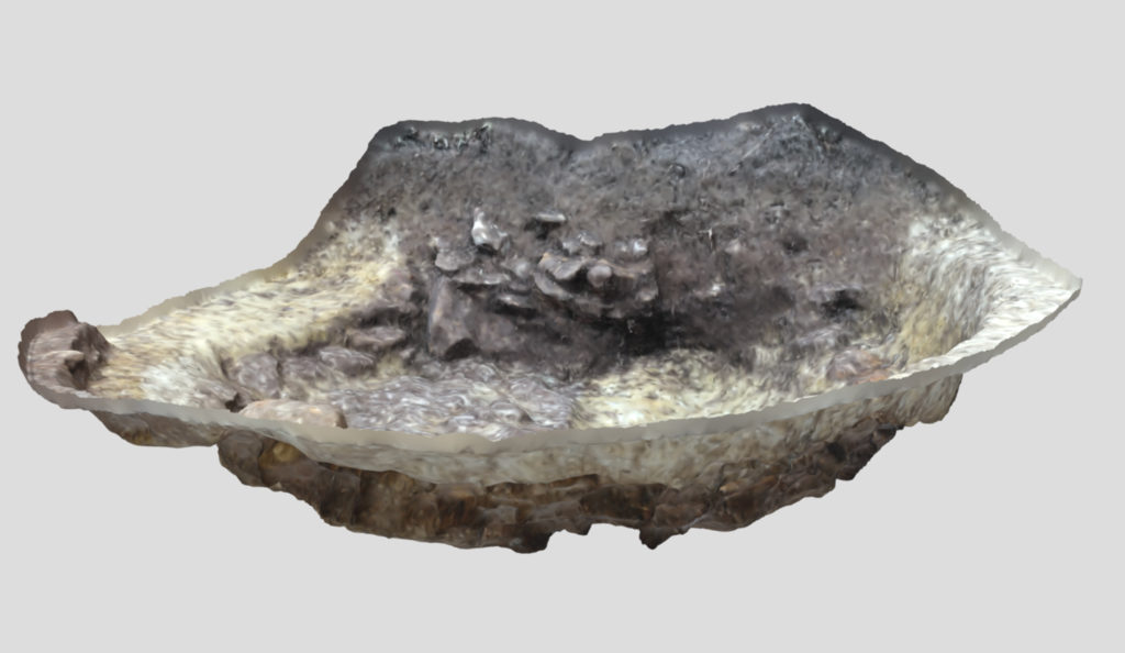
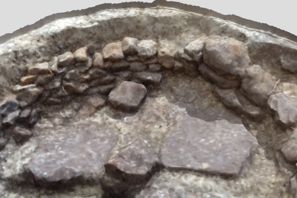
Below is an example of a 3D model of a stone lined storage pit found in Oxfordshire, possibly used to store food and perishable items. – Stone Lined Pit 003020 – 3D model by borderarchaeology.com
Stone Lined Pit 003020 by borderarchaeology on Sketchfab
To view more of our Photogrammetry models click on this link.