


Geophysical Survey & Archaeological Field Evaluation, Buckinghamshire
Photo 1: External side of antler knife handle
Photo 2: Internal side of antler knife handle
A short tour of some of our interesting projects, both archaeological and heritage, over the last 29 years.
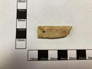
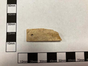
Photo 1: External side of antler knife handle
Photo 2: Internal side of antler knife handle
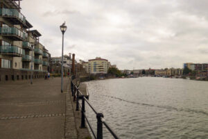
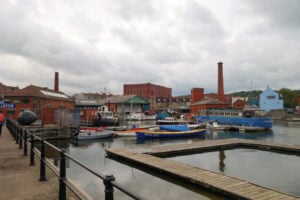
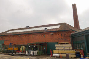
Photo 1: View towards Capricorn Place and Canons Marsh
Photo 2: View from outside The Cottagetowards the Underfall Yard
Photo 3: View looking S towards the Grade II listed Machine House
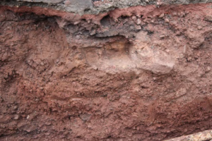
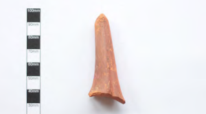
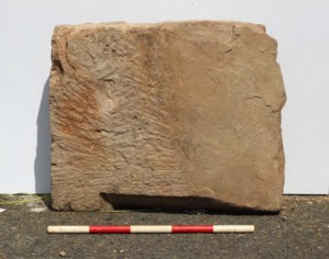
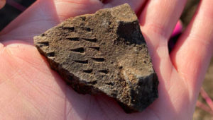
Photo 1: Possible masonry foundation remains relating to the medieval Friar’s Gate
Photo 2: Malvernian oxidized glazed ware skillet
Photo 3: Masonry fragment dated to 17th or 18th century
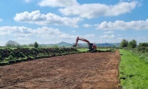
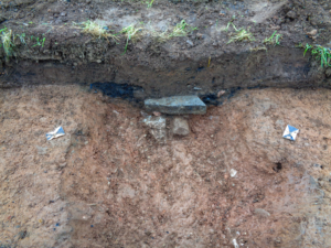
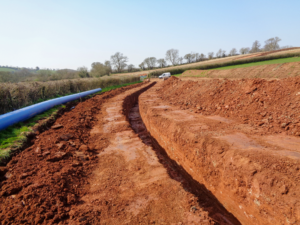
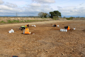
Photo 1 Topsoil stripping underway
Photo 2 Probable culvert
Photo 3 View looking along pipeline
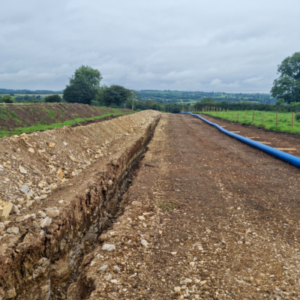
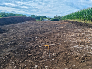
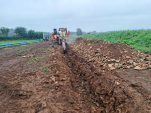
Photo 1 Long-range view of pipeline
Photo 2 Post-medieval pottery recovered
Photo 3 Works in progress
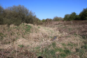
Photo 1 View looking towards the site
Photo 2 Overall assessment determined Low to Moderate potential
Photo 3 Development considered to have a Neutral impact in Heritage terms
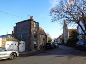
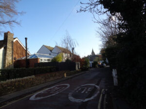
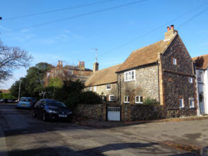
Photo 1: View looking ESE within the Conservation Area of Reading Street
Photo 2: View looking SE towards the historic core of Reading Street, with the spire of St Andrew’s Church
Photo 3: View NW along Reading Street towards two Grade II listed buildings
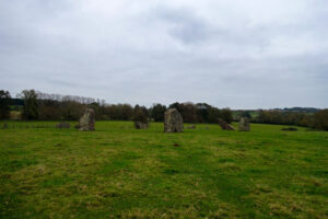
Photo 1: Stanton Drew Circles
Photo 2: Archaeologically rich landscape of the Lower Chew Valley
Photo 3: Iron Age hillfort of Maes Knoll and the West Wansdyke
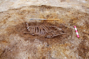
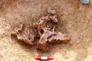
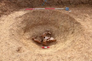
Photo 1 Ritualistic burials and deposition indicate a votive offering
Photo 2 Burial of nine cattle skulls
Photo 3 Animal remains relating to probable ritual deposition
Photos 1 Probable Bronze Age ring-ditch
Photo 2 Excavations in progress
Photo 3 Post-hole with wood fragments dated to c.3770-3648 cal. BC
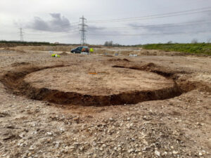
Photo 1 Aerial shot of trial trenches
Photos 2 View showing wider landscape
Photo 3 Full scale of evaluation works
The ASIDOHL 2 methodology is a staged process of quantified assessment developed by NRW to determine the Historic Landscape implications of proposed development. It considers both direct and indirect physical impacts as well as non-physical visual aspects
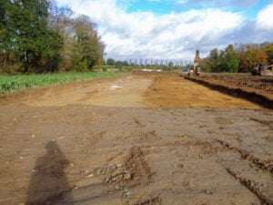
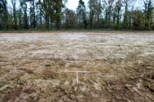
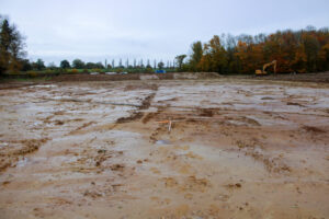
Photo 1: Strip, Map & Record excavation
Photo 2: Previous Evaluation revealed possible Mid to Late Iron Age activity
Photo 3: Mitigation confirmed the presence of a Mid to Late Iron Age settlement
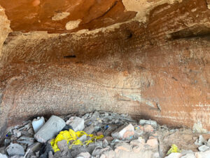
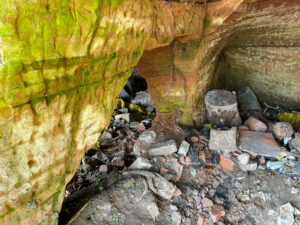
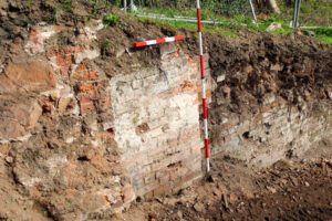
Photo 1: Cave 1 interior viewed looking W from entrance
Photo 2: View from entrance to Cave 2 looking SW through onto Cave 1 showing brick rubble and modern refuse
Photo 3: View ENE adjacent to the proposed access road showing brick pier or ornamental feature associated with the formal garden layout
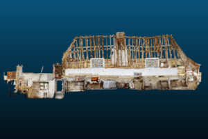
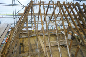

Photo 1: 3D Laser Scan
Photo 2: Photo of roof structure
Photo 3: Illustration showing features
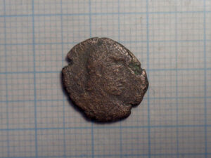
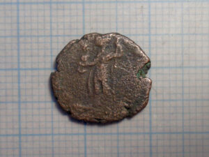
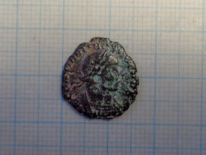
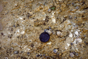
Photo 1: Copper alloy coin. Profile of a male facing proper left wearing a laurel wreath or helm
Photo 2: Copper alloy coin. Figure facing proper right with an outstretched hand
Photo 3: Profile of a male facing proper left wearing a crown
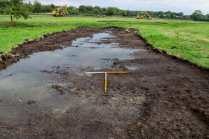
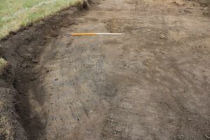
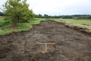
Photo 1: Post-excavation view of Area
Photo 2: One of two areas of modern burning/patches of charcoal in Area
Photo 3: Post-excavation view of Area 003 showing the Honeypot Stream on the left
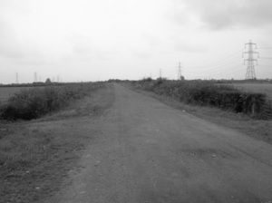
Photo 1: Assessment determined the Historic Landscape implications of the proposed wind turbine scheme
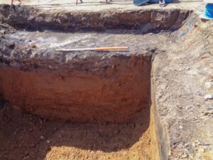
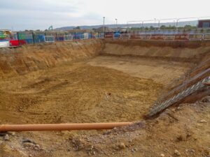
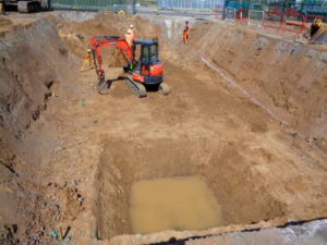
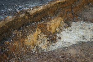
Photo 1 Section and scale
Photo 2 Wide-ranging view of works underway
Photo 3 Palaeolithic and Pleistocene Geoarchaeological watching brief
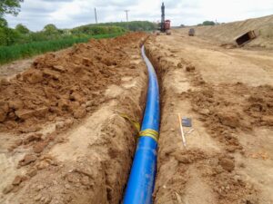
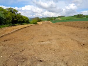
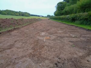
Photo 1 View along pipeline route
Photo 2 Part of the route followed the course of Pilgrims Way, a trackway of prehistoric origin
Photo 3 Topsoil stripping complete
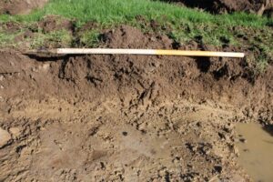
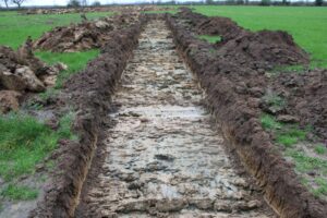
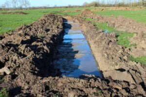
Photo 1: Indications of medieval/post early medieval cultivation features
Photo 2: Programme of fieldwork with 30 trenches excavated
Photo 3: Propensity of the site to flood may have meant it was considered unsuitable for occupation

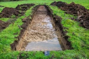
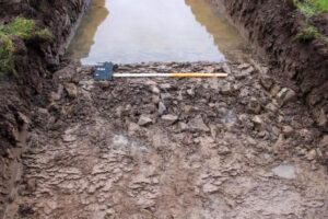
Photo 1: 30 trenches excavated across the site
Photo 2: Post-medieval field boundaries uncovered
Photo 3: Little datable evidence found apart from medieval pottery
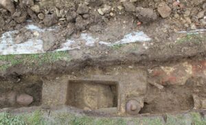
Photo 1: plan view of inspection chamber and associated pipe
Photo 2: possible remains of structure shown abutting Barracks on the 1947 Ordnance Survey map or a ‘Tank’ marked on the plan of 1914
Photo 3: mixed assemblage of post-medieval finds
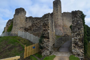
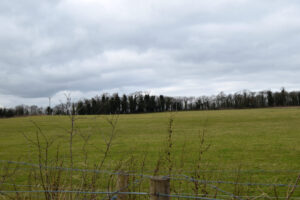
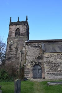
Photo 1: View of Conisbrough Castle
Photo 2: View looking across site
Photo 3: Church of St John the Baptist
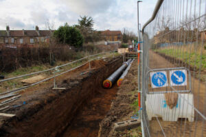
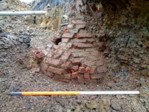
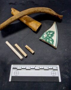
Photo 1 Open-cut trenching for the pipeline
Photo 2 Post-medieval brick-built water cisterns
Photo 3 Fragments of China pottery, CBM and Clay Tobacco Pipe
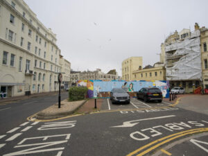
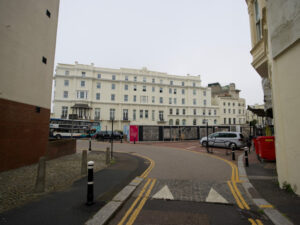
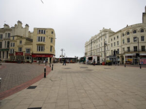
Photo 1: view looking W from Pelham Street, overlooked by the Queens Hotel
Photo 2: view looking S where Harold Place, Havelock Road, Station Road, Queen’s Road, Wellington Place and Robertson Street converge
Photo 3: view looking W from Hastings Castle across the western portion of Hastings Town Centre
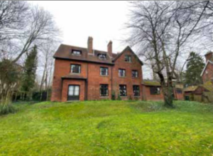
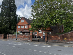
Photo 1: View looking towards The Knott
Photo 2: View looking W from Lady Margaret Road
Photo 3: View showing the garden to the rear of The Gables
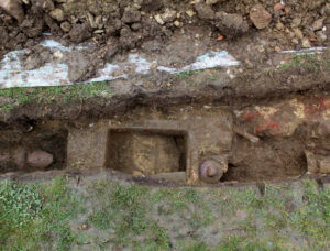
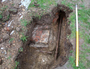
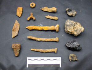
Photo 1: overview of 19th century sewerage
Photo 2: possible remains of structure shown abutting Barracks on the 1947 Ordnance Survey map
Plate 7: with caption “Photo 3: mixed assemblage of post-medieval finds”

Photo 1: view east-southeast showing the southern end of the Milne Graden Footbridge
Photo 2: view W showing the stone bridge and Graden Burn
Photo 3: looking E towards Milne Graden
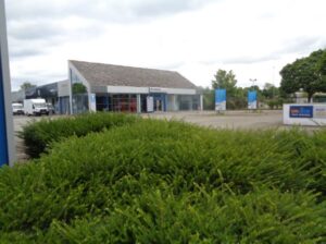
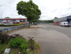
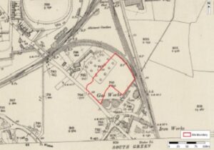
Photo 1: Looking E/NE from Yaxham Road
Photo 2: NW extent of site
Photo 3: Extract from the 1906 Ordnance Survey map
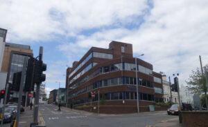
Photo 1: view towards Lambert House at the crossroads with Talbot Street and Clarendon Street
Photo 2: view towards main street frontage of Stanley House, formerly Lambert’s factory built in 1863
Photo 3: view towards Nottingham General Cemetery gatehouse and flanking almhouses (Grade II listed)
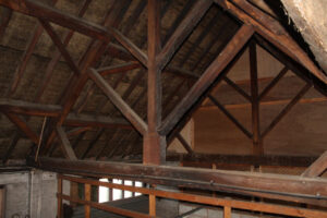
Photo 1: view looking towards the western wing of the former stables within the curtilage of the Grade II listed town hall
Photo 2: external view of the north-facing elevation of the central range
Photo 3: roof trusses within the west wing
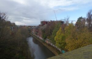
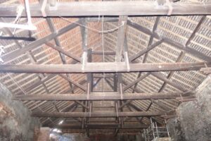
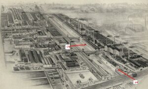
Photo 1: Looking WNW from Spon Bridge along Telford’s New Main Line Canal
Photo 2: View looking E showing detail of queenpost roof trusses
Photo 3: Engraving from early 20th century looking W
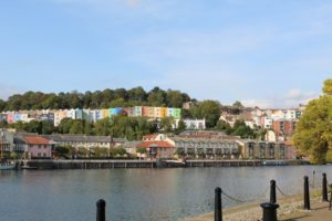
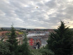
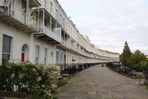
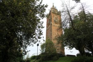
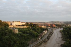
Photo 1: view from the quayside towards Clifton Wood Slopes
Photo 2: view towards the Floating Harbour and Underfall Yard
Photo 3: view along the west portion of Royal York Crescent
Photo 4: view looking west towards the Grade II listed Cabot Tower
Photo 5: view from the viewing platform of the Clifton Suspension Bridge
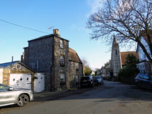
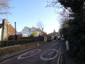
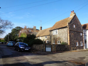
Photo 1: view looking ESE within the Conservation Area of Reading Street
Photo 2: view looking SE towards the historic core of Reading Street, with the spire of St Andrew’s Church
Photo 3: view NW along Reading Street towards two Grade II listed buildings
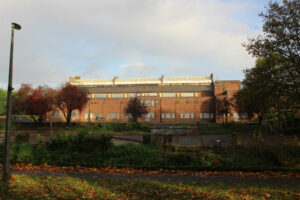
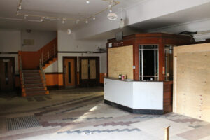
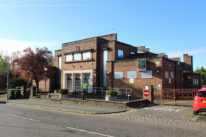
Photo 1: entrance to the former swimming baths of late 1930s date
Photo 2: foyer with decorative tiled floor and kiosk
Photo 3: view from Valley Park showing the south facing elevation of the baths
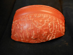
Photo 1: Incredible find in-situ
Photo 2: Samian recovered from site
Photo 3: Drone’s view of archaeologists on site
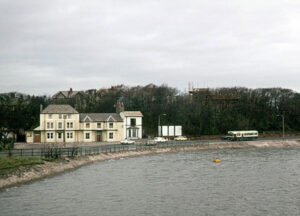
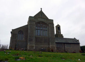
Photo 1: view looking NW towards the Ferry Hotel
Photo 2: photograph taken in 1977 looking NW
Photo 3: view looking W towards St Mary’s Church
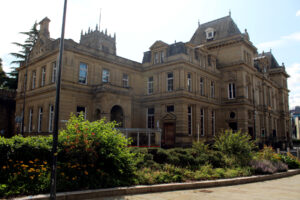
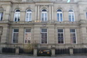

Photo 1: External shot of building
Photo 2: Front of Building
Photo 3: View of ornate stonework
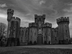
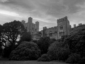
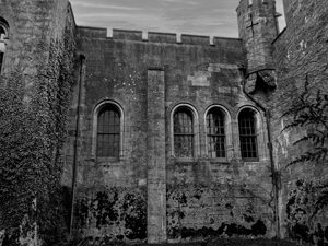
Photo 1: Front exterior of Castle
Photo 2: View of castle amongst foliage
Photo 3: View of exterior wall showing arched windows
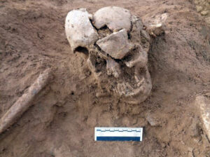
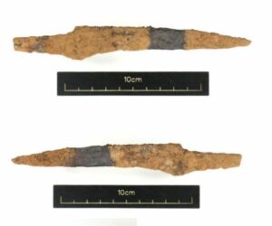
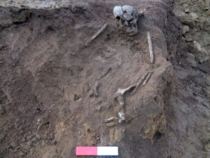
Photo 1: Skull of SK5 looking West
Photo 2: Iron object, possible blade and tang
Photo 3: SK5 showing knife in pelvic region
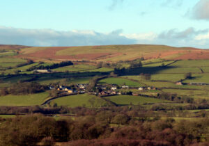
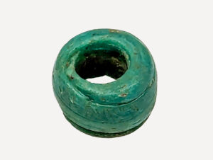
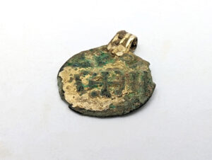
Photo 1: One of many jewellery items recovered on site
Photo 2: Circular pendant with possible cross motif
Photo 3: Exciting programme of community outreach
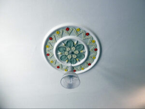
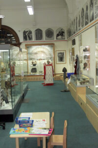
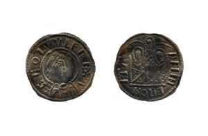
Photo 1: View of plaster ceiling rose light fitting
Photo 2: View showing some of the museum displays
Photo 3: Two emperor’ type coins showing political alliance between the Kingdoms of Wessex and Mercia in the late 9th
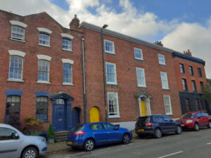
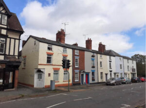
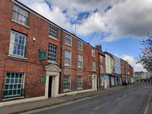
Photo 1: Grade II listed late Georgian townhouses at Nos. 18, 20 & 22 Etnam Street
Photo 2: Row of Grade II listed houses at Nos. 77-85 Etnam Street including the former Dukes Arms public house
Photo 3: West side of South Street, predominantly late Georgian in character
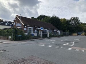
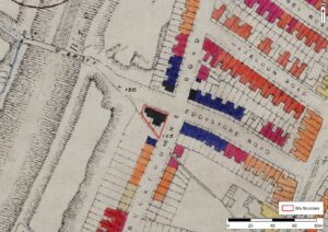
Photo 1: Looking W towards Beaufort-Roberts Memorial Hall
Photo 2: Looking SE showing rear of site and Brockley footpath
Photo 3: Extract from the LCC Bomb Damage Map from 1946
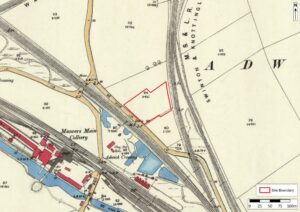
Photo 1 View SE along Wath Road
Photo 2 Extract from OS 2nd Edition Survey of Yorkshire (1892)

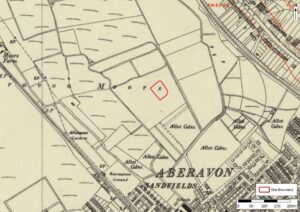
Photo 1: Looking SE across site
Photo 2; Extract from OS 4th Edition of Glamorgan (1952)
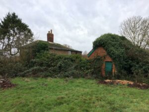
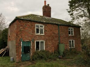
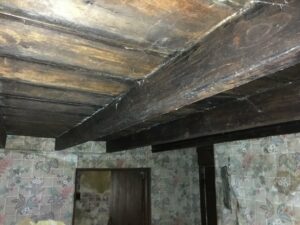
Photo 1: View towards rear of cottage and associated outbuilding
Photo 2: External view looking NNE towards cottage
Photo 3: Internal view of the ceiling timbers
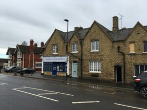
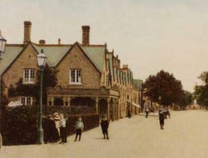
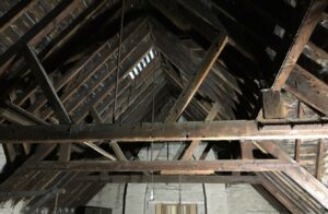
Photo 1: View NW showing exterior along Wisbech Road
Photo 2: Extract from a photograph looking E along Wisbech Road
Photo 3: View NNW showing detail of trusses in central and northern bays
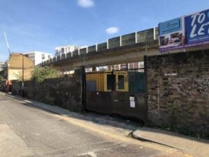
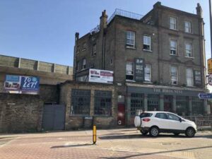
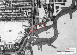
Photo 1: Looking SE towards site
Photo 2: Showing N facing elevation of the public house with yard to rear
Photo 3: Extract from tithe map of Deptford parish in 1844
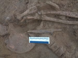
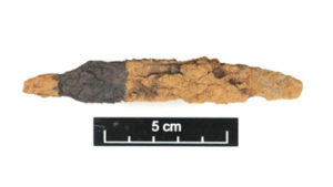
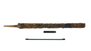
Photo 1: whittle tang knife in-situ in the pelvic area
Photo 2: iron object, possibly a blade and tang
Photo 3: iron sword.
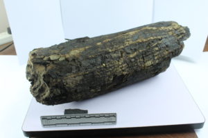
Photo 1. Preserved wood from waterlogged deposit next to the Thames taken for analysis to see if it related to a prehistoric trackway found in the vicinity. In house investigations concluded this wasn’t worked wood and most likely the result of flooding and natural deposition.
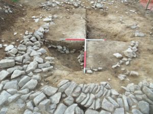
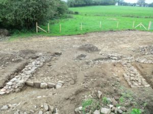
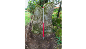
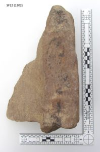
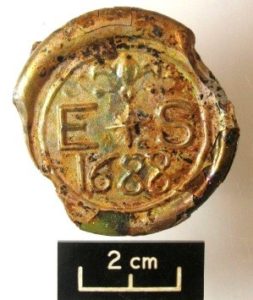
Photo 1: stone structure
Photo 2: view SW from rear of 15th-18th century building
Photo 3: boundary stone
Photo 4: worked masonry showing evidence of tooling
Photo 5: glass bottle base with cartouche
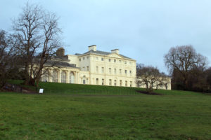
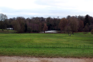
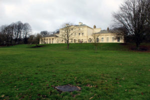
Photo 1: Kenwood House
Photo 2: view from the south terrace
Photo 3: looking NW towards Kenwood House
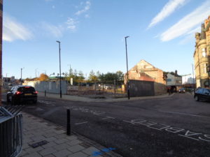
Photo 1: works in progress
Photo 2: Co-operative building from 1900
Photo 3: general shot of site
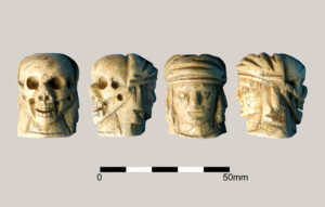
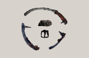
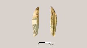
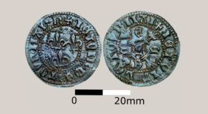
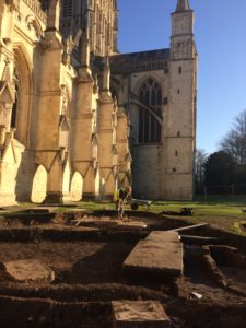
Photo 1: Momento Mori made from bone probably a terminal bead for a late Mediaeval rosary
Photo 2: Post – Mediaeval leg prosthesis to hold a wooden leg to the remaining stump of an amputee
Photo 3: worked bone
Photo 4: Cu coin
Photo 5: cold day on site
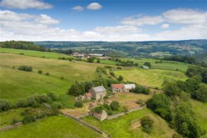
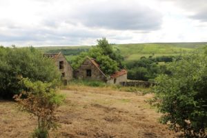
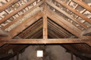
Photo 1. external shot of farmhouse.
Photo 2: oblique shot of farmhouse
Photo 3: roof timbers completing a full photographic and written survey of an historic building.
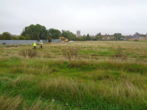
Photo 1: football pitch looking towards Stamford town. They think its all over, it is now!
Photo 2: iconic signage
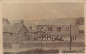

Photo 1: school days 1890’s style
Photo 2: external shot of school buildings
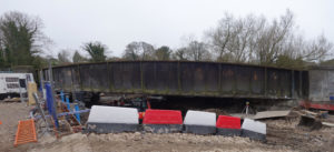
Photo 1: C19th railway bridge over a canalised section of the River Kennet, interestingly known as ‘Skinners Lock’ but there has never been a lock on this area of the canal.
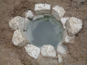
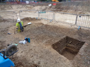
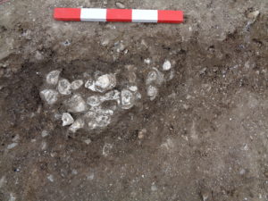
Photo 1: one of the many wells on site
Photo 2: section in progress
Photo 3: oyster shells
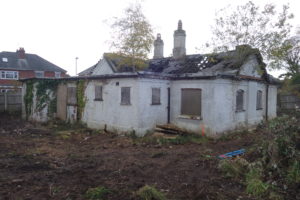
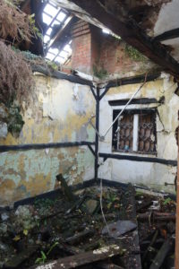
Photo 1: external shot of The Lodge
Photo 2: Internal shot of the Lodge
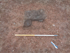
Photo 1: Bronze Age Vessel in-situ mid-excavation
Photo 2: view N of ditch cutting gullies
Photo 3: view SW of pit showing remains of vessels”
Photos 1 and 2: showing the geological process of solifluction; the deposits left behind after the movement of soils through periods of glaciation and thaw in the geological past.
Photos 1 and 2: base of the medieval town walls including a dungeon or ‘Oubliette’, a place where people would literally be ‘forgotten’.
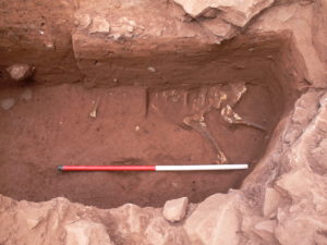
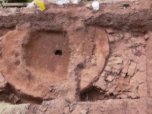
Photo 1: a ‘ritual’ horse burial
Photo 2: an extremely unusual square structure with a circular inner chamber purpose unknown of Romano-British date
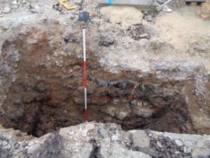
Photo 1: a post excavation shot of one of 53 pre-pile pits excavated in preparation of building works
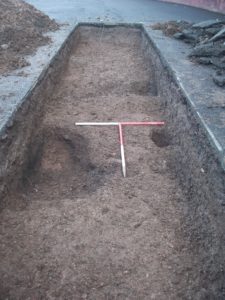
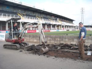
Photo 1: spot the ball! competition just got a bit serious (trench opening).
Photo 2: possible Neolithic pit beneath the goalposts! Sometimes we can only infer the date of a feature. The pits uncovered in this evaluation were structurally and stratigraphically similar to some discovered 20m south of the site during earlier archaeological investigation. That site had material dating to the Neolithic/ Bronze Age within the feature.
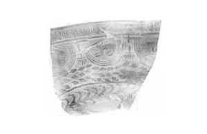
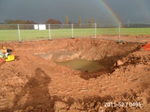
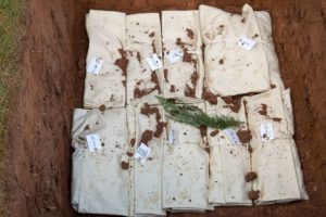
Photo 1: a ghostly image of Roman fine dining
Photo 2: gold?’ at the end of the rainbow
Photo 3: reburial service at local church with due reverence for our ancestors. This site produced evidence for cremation and inhumation burials together with domestic occupation from C2nd to the C7thAD
Significant archaeology was identified in a portion of the site and it was determined that further excavation needed to take place in order to fully record the assets of interest.
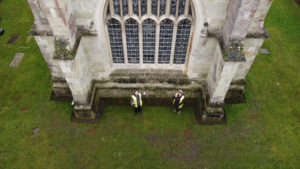
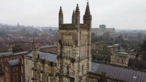
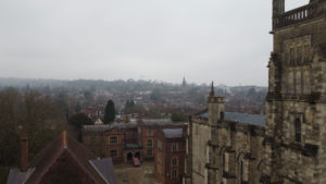
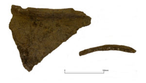
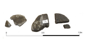
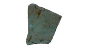
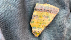
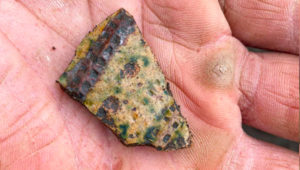
Photo 1: Examples of mid-11th century domestic pottery
Photo 2: Fragments of quern stone
Photo 3: Fragment of coloured glass
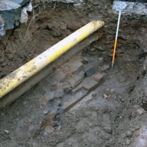
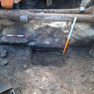
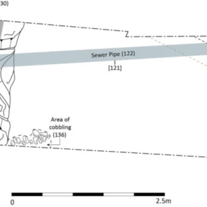
Photo 1
Photo 2
Photo 3
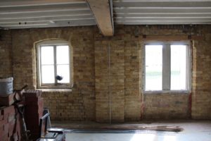

Photo 1: Internal view showing former loading bay door
Photo 2: South east facing elevation of old granary
Photo 1: Grade II listed brick kiln
Photo 2: Surviving example of mid 19th century Dutch type kiln
Photo 3: Heavily dilapidated and overgrown condition
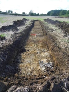
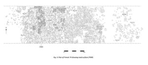
Photo 1: 85 trenches were excavated
Photo 2: No evidence was revealed of the Battle of Nibley Green
Photo 3: Illustration of road surface (evidence of the Roman road)
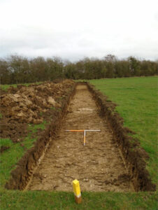
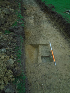
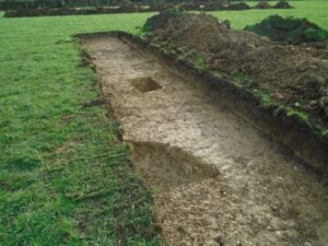
Photo 1: 14 evaluation trenches were excavated
Photo 2: No evidence found to indicate the Second World War signal station complex
Photo 3: Medieval and post-medieval agricultural features were revealed
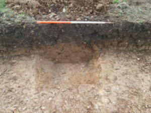
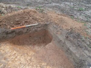
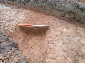
Photo 1: Evidence of Romano-British settlement and 19th -century quarrying
Photo 2: 50 trenches excavated across site
Photo 3: Significant remains of a moderately sized, early Romano-British enclosure were uncovered
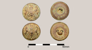
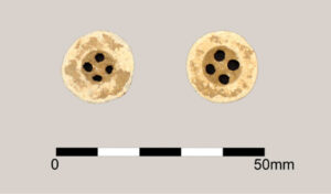
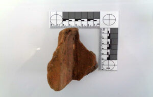
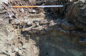
Photo 1: Brass buttons depicting the King’s crown on the obverse and manufacturers stamp on the reverse
Photo 2: Copper buttons (obverse)
Photo 3: Possible fragment of Roman Tegula (unstratified topsoil context)
Photo 4: Drystone Ragstone Wall
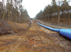
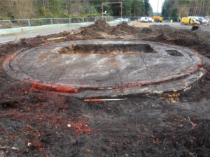
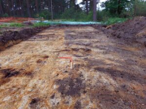
Photo 1 Long-range view along pipeline
Photo 2 20th-century military activity landscape was encountered
Photo 3 Topsoil stripping complete
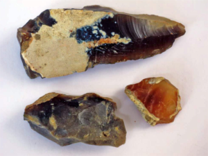
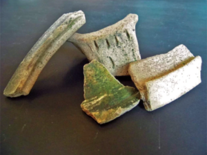
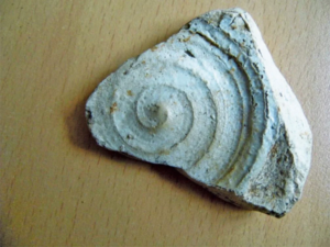
Photo 1 Prehistoric flint scatters
Photo 2 Coarse Border ware
Photo 3 Probable 15th to 16th-century Siegburg stoneware
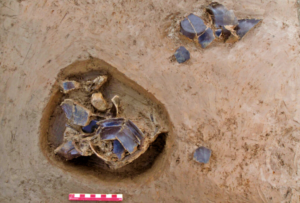
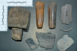
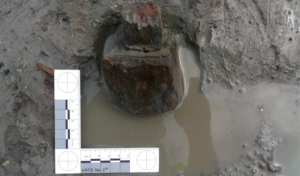
Photo 1 Pot Burials
Photo 2 Artefacts retrieved from the late Bronze Age/Early Iron Age level
Photo 3 View wooden mallet in-situ
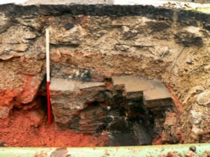
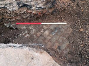
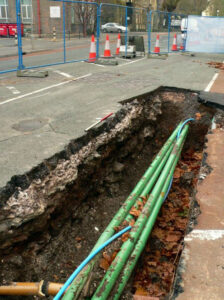
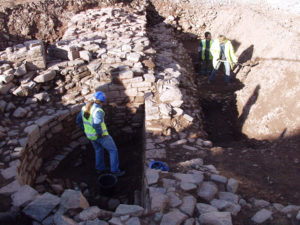
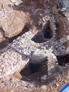
Photo 1 Remains of sandstone masonry walls
Photo 2 Cellarage of late medieval or early post-medieval houses
Photo 3 Trench section
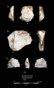
Photo 1 Lithic material
Photo 2 Possible marker stone
Photo 3 Post-excavation photograph of tree-bole
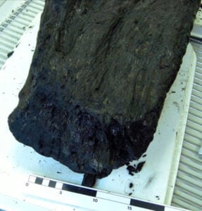
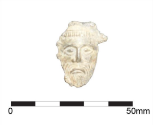
Photo 1 Example of ridge and furrow cultivation
Photo 2 Green Man, possibly an item of horse furniture
Photo 3 Possible ‘tenon’ on prehistoric wood from peat sample
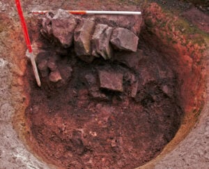
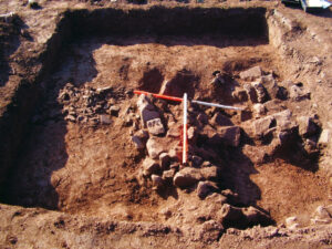
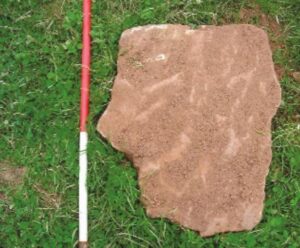
Photo 1 View showing masonry deposit at base
Photo 2 View west showing rectilinear masonry wall foundations
Photo 3 Large recumbent sandstone
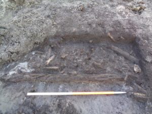
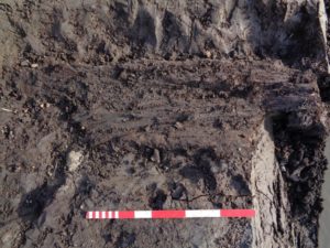
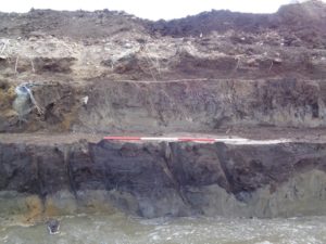
Photo 1: A cluster of timbers within a peat layer
Photo 2: Decayed wood within a peat layer
Photo 3: Stepped excavation trench showing basal deposit and peat on lower step
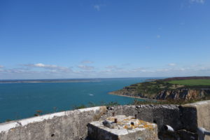
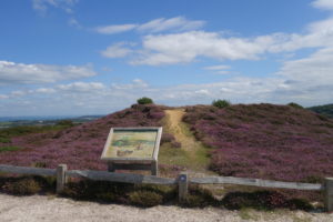
Photo 1: Looking out from the battlements
Photo 2: View of castle wall
Photo 3: Walking around the perimeter
Photo 4: Headon Warren
Approximate locations